

Ecotrail from Amarante to Arco-de-Baúlhe
through Celorico de Basto
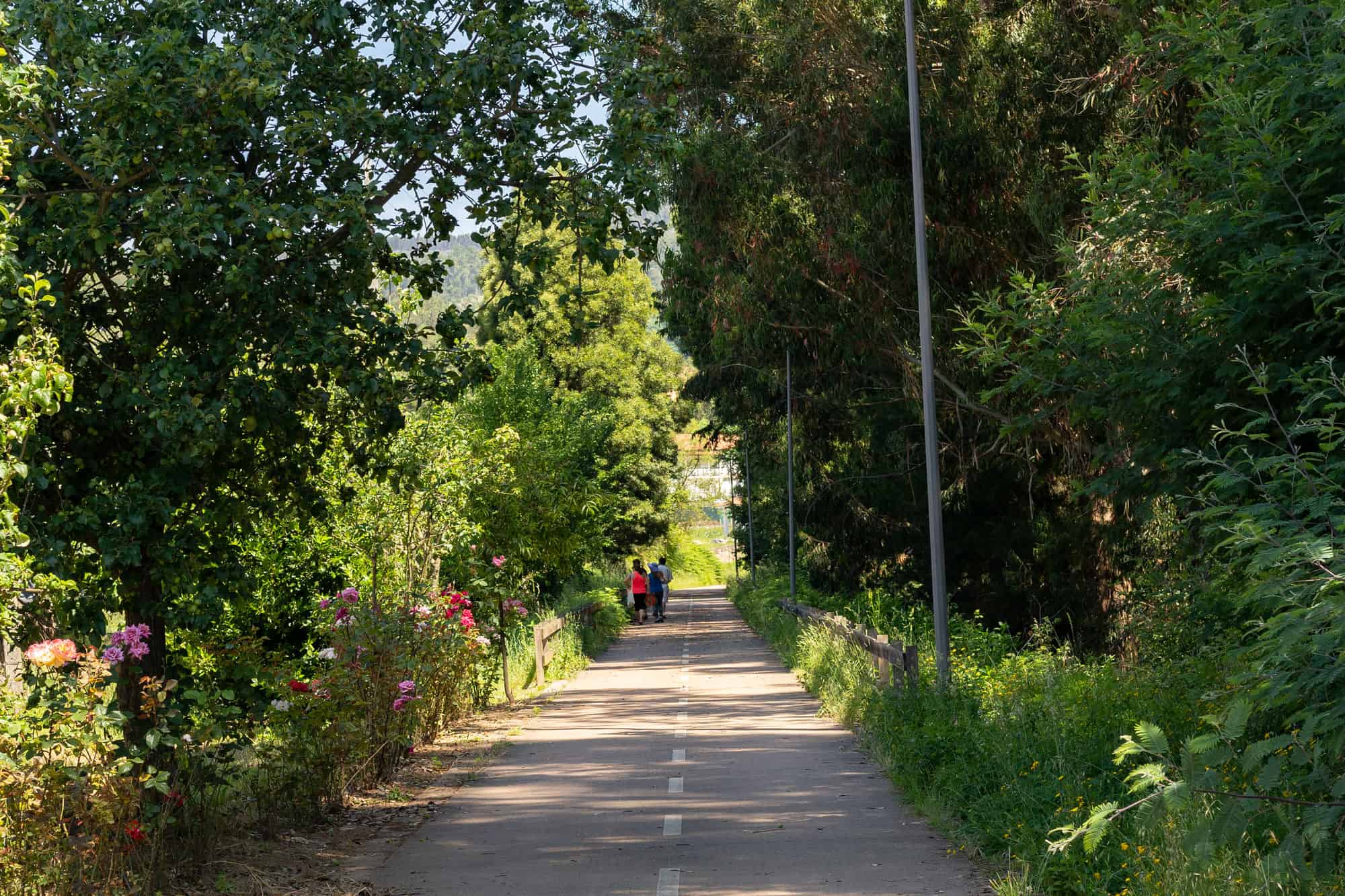


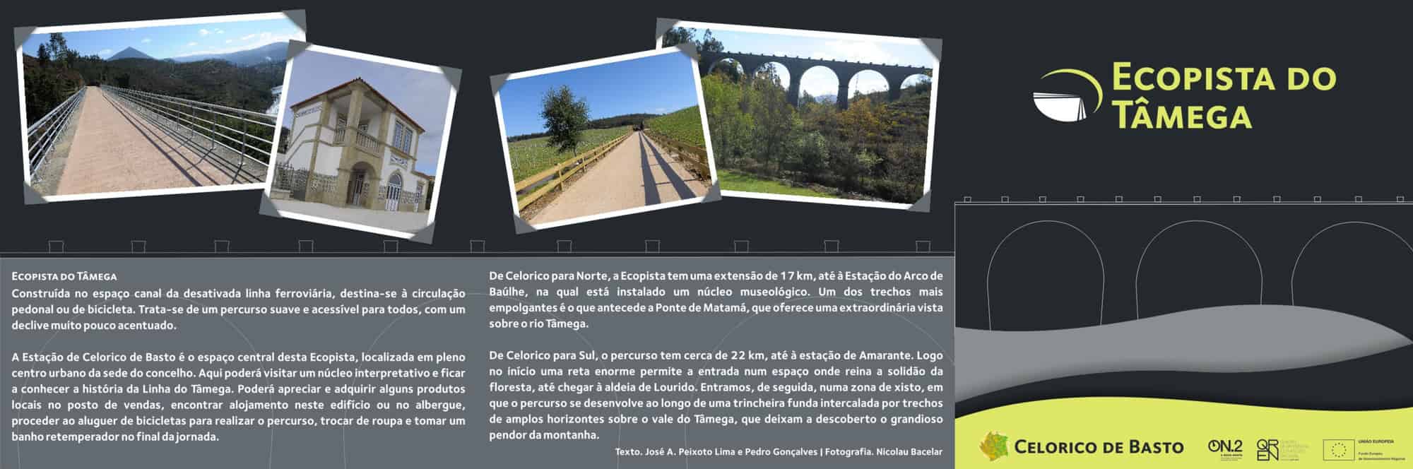
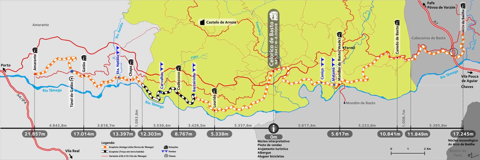

Tâmega ecotrail, built in deactivated railway line, is at present used for pedestrian or bicycle leisure. It is a gentle and accessible route for everyone, with a very low slope.
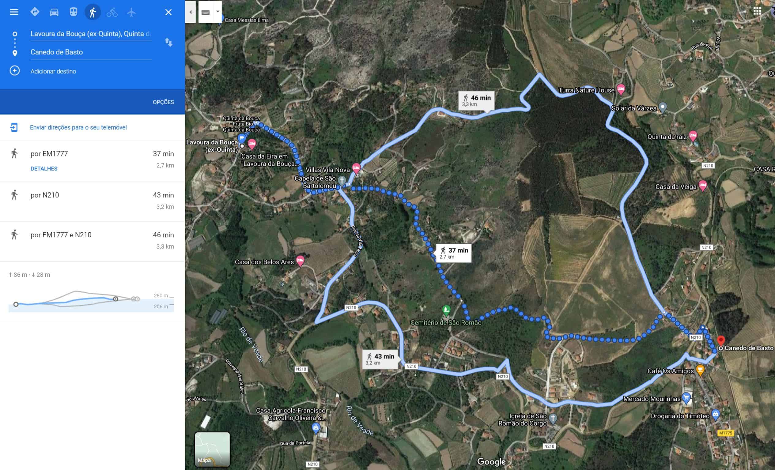
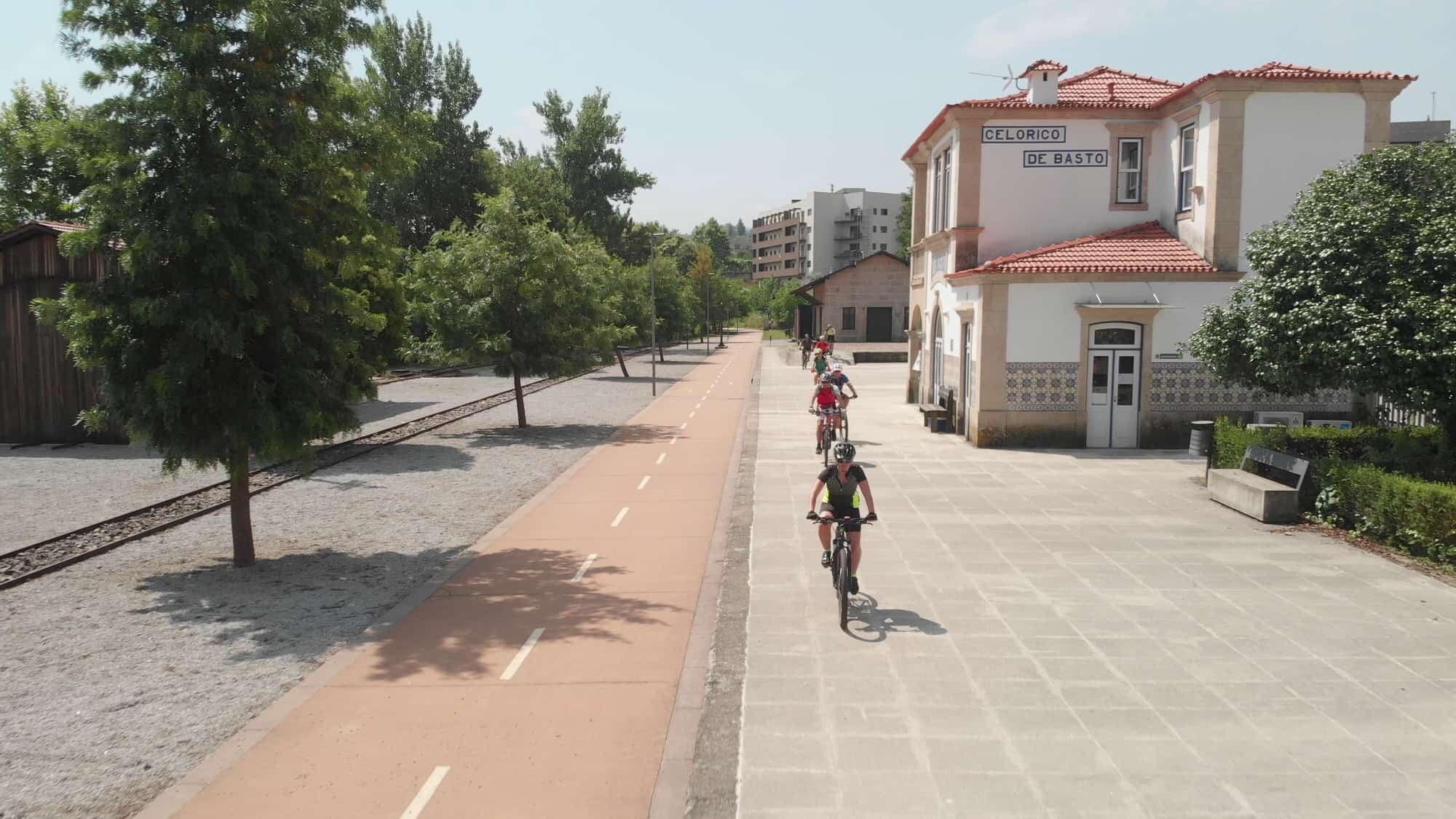
Celorico de Basto Station is the central space of this ecotrail, located in the heart of the urban center. Here you can visit an interpretive center and learn about the history of the tâmega line. Here, it is possible to enjoy and purchase some local products at the sales point, find accommodation in this building or at the hostel, rent a bicycle to complete the route, change your clothes and take a refreshing shower at the end of the day.
From Celorico to the North, it has 17 km long, until Arco-de-Baúlhe Station, where a museum is located. One of the most attractive stretches is the one before the Matamá Bridge, in Veade, which offers an extraordinary view over the Tâmega River.
From Celorico to the South, the route is around 22 km, to Amarante station. Right at the beginning, a huge straight line allows you to enter a space where the solitude of the forest reigns, until you reach the village of Lourido. We then enter a shale area, where the route runs along a deep trench interspersed with stretches of wide horizons over the Tâmega valley, which reveal the mountain’s grand slope.
Links externos:
Portuguese Trails
Wikipedia
Ciclovias Norte
Passeio com BTT Famalicão
Informação em Rota do Românico
Informação em Porto e Norte
BTT Club
Mapas
Mapa Google
WikiLoc